


In 2025, farming in the UK is embracing cutting-edge technology, and drones are leading this revolution. Crop monitoring drones are changing how British farmers work, offering fast, accurate, and cost-effective ways to manage crops. From scanning fields to identifying plant health, these flying tools are being used on farms across England, Wales, Scotland, and Northern Ireland.
This guide explains everything UK farmers need to know about crop monitoring drones in 2025—from how they work to the top models, real farm case studies, available grants, and future trends.
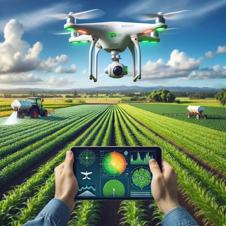
What Are Crop Monitoring Drones?


Crop monitoring drones are unmanned aerial vehicles (UAVs) equipped with advanced sensors and high-resolution cameras that scan and analyse farmland from above. These drones capture real-time data about plant health, soil condition, crop maturity, and potential threats like pests or diseases. This data enables British farmers to make faster, more accurate decisions about irrigation, fertiliser application, disease treatment, and yield planning.
In 2025, around 38% of medium-to-large UK farms are using some form of drone technology (DEFRA Smart Farming Report), and the number is rapidly growing across counties like Lincolnshire, Somerset, and Aberdeenshire.
Types of Crop Monitoring Drones (Used in the UK)
1. Fixed-Wing Drones
-
Best for: Large farms and open-field crops like wheat, barley, or rapeseed.
-
Popular regions: East Anglia, Yorkshire, Scottish Lowlands.
-
Flight Capacity: Covers 300–500 hectares per flight with up to 50 km range.
-
Advantages: Long flight time, high coverage, faster data collection.
-
Example: SenseFly eBee X used in Yorkshire’s arable farms for full-season crop monitoring.
2. Multi-Rotor Drones
-
Best for: Orchards, vineyards, or irregularly shaped fields.
-
Popular regions: Welsh Valleys, Cornwall, Kent, and Cumbria.
-
Flight Capacity: 10–50 hectares per flight; hover for pinpoint inspections.
-
Advantages: Better manoeuvrability, ideal for close-up or low-altitude imagery.
-
Example: DJI Mavic 3 Multispectral used by fruit growers in Kent for bloom density and disease checks.
Common Sensors and Their Uses (2025 Tech Overview)
| Sensor Type | Function | UK Farm Use Example |
|---|---|---|
| RGB Cameras | Capture visible spectrum images to detect growth patterns or bare spots. | Used in Devon vegetable farms for monitoring leaf cover. |
| Multispectral Sensors | Provide NDVI imagery to detect nutrient stress and chlorophyll content. | Employed in Norfolk beet farms to identify virus yellows. |
| Thermal Cameras | Identify differences in temperature to assess irrigation and drought stress. | Used in Lincolnshire potato fields to optimise watering zones. |
| LIDAR (Light Detection and Ranging) | Generate 3D maps to measure canopy height and surface elevation. | Helps in slope analysis and planning drainage in Cumbria hills. |
Emerging Sensor Technology in 2025
-
Hyperspectral Sensors: Offer ultra-fine spectral analysis to detect diseases like Septoria tritici in wheat before symptoms are visible.
-
CO₂ Sensors: Measure plant respiration to predict yield potential and detect crop stress more accurately.
-
Fluorescence Imaging: Provides insights into photosynthetic efficiency—being tested in Innovate UK pilot farms in Oxfordshire.
Why This Matters for UK Farmers


With unpredictable weather patterns and stricter environmental rules under the UK’s Environmental Land Management scheme (ELMs), drones help farmers reduce input waste, comply with regulations, and remain profitable. Whether it’s a sugar beet farm in Ely or a dairy pasture in Dumfries, crop monitoring drones are proving essential for smart, sustainable agriculture in 2025.
How Crop Monitoring Drones Work
- Flight Planning: Farmers use an app to plan flight paths, often based on crop type, season, and current issues.
- Autonomous Flight: Drones follow pre-set paths using GPS and RTK (real-time kinematic) positioning for greater accuracy.
- Data Capture: Drones take hundreds or thousands of images during each flight, even capturing ultra-high-resolution data at centimetre level.
- Data Processing: Software such as Pix4Dfields, DroneDeploy, or Agremo converts raw images into useful orthomosaic maps, heatmaps, and 3D models.
- Actionable Insights: Farmers review these outputs to spot issues such as pest pressure, crop lodging, or uneven growth patterns.
Crop monitoring drones are no longer just experimental tools—they are mainstream farm assets that deliver measurable benefits across British agriculture. From boosting yields to saving time and improving eco-practices, here’s how UK farmers are benefiting in 2025.
Early Detection of Problems
-
Spot issues early: Drones can detect diseases like potato blight, cereal rust, powdery mildew, and leaf spot days or even weeks before symptoms are visible to the naked eye.
-
Insect and pest alerts: Detect signs of aphid outbreaks, caterpillar trails, or flea beetle damage, helping farmers intervene with targeted pest control.
-
Zonal analysis: NDVI and thermal imaging show nutrient deficiencies or water stress in specific patches, allowing precision treatment.
-
Case Example: In Cambridgeshire, drone scanning helped spot barley yellow dwarf virus early, saving an estimated £24,000 in potential crop losses on a 150-hectare farm.
Higher Yields with Less Waste
-
Precision input application: Drones ensure variable rate application of fertilisers, sprays, and irrigation, reducing costs and chemical overuse.
-
Yield boost: Farms using drone-guided decisions report 25–35% yield increases, especially in crops like oilseed rape, wheat, and sugar beet.
-
Better harvest timing: Thermal and spectral imaging allows accurate predictions of optimal harvest windows to minimise losses.
-
Real-World Gain: A Yorkshire arable farm increased rapeseed output by 28% over two seasons after adopting multispectral drone monitoring.
Labour Savings
-
Time-saving scouting: One drone can scout 100+ hectares in just 25–30 minutes, replacing hours of manual foot inspections.
-
Manpower efficiency: Reduces need for frequent field visits by agronomists or workers. Large farms report saving 10–20 labour hours weekly.
-
Seasonal reliability: Helpful during peak work periods (e.g. spraying, harvesting) when labour is stretched.
-
Tech Integration: Some drones now auto-upload field data to farm management systems, reducing the need for manual logging and paperwork.
Sustainability
-
Eco-friendly operations: Reduced tractor use for scouting lowers diesel consumption and CO₂ emissions—supporting carbon-smart farming under DEFRA’s climate goals.
-
Targeted spraying: Drones enable zone-specific treatment, which protects beneficial insects like bees and ladybirds, and reduces environmental runoff.
-
Water conservation: Thermal sensors help identify over- and under-irrigated areas, optimising water use especially in drought-prone regions like East Anglia.
-
Biodiversity Boost: Some drone systems map and avoid habitats of ground-nesting birds or protected wildflower zones.
Improved Profit Margins
-
Direct financial impact: According to the 2024 NFU Tech Report, UK farms using drones for at least 12 months reported an average 12–18% increase in net profit.
-
Cost savings: Reductions in fertiliser, pesticide, and fuel use translate to £600–£1,200 savings per hectare annually.
-
Input ROI: Initial investment in drones (starting at £2,000–£3,000) is often recovered within 1–2 growing seasons.
-
Scalability: Margins improve further when drone insights are paired with AI-based decision tools or autonomous ground vehicle.
Use Cases Across the UK
-

Crop monitoring drones are being successfully used across the UK in various terrains and farm types. Here are real-world examples of how drones are transforming farming practices in different regions:
Kent Orchards
-
What’s Monitored: Tree health, blossom density, fruit maturity, and irrigation levels.
-
Drone Use: Drones equipped with multispectral sensors help identify early signs of apple scab or fire blight, monitor blossom development for pollination management, and guide precision spraying.
-
Impact: Reduced fungicide use by up to 30% while increasing fruit grade consistency.
Cotswold Grain Fields
-
What’s Monitored: Growth stages, nitrogen uptake, and harvest readiness.
-
Drone Use: NDVI imaging helps with split fertiliser application based on crop need and identifies lodging areas before harvest.
-
Impact: Helped increase winter wheat yields by up to 18% on trial plots in Gloucestershire.
Highland Pastures (Scotland)
-
What’s Monitored: Grass biomass, grazing patterns, and field recovery.
-
Drone Use: Thermal and RGB mapping helps monitor rotational grazing schedules, preventing overgrazing and allowing better pasture regeneration.
-
Impact: Boosted grassland productivity by over 20%, especially for sheep and cattle grazing.
Norfolk Sugar Beet Farms
-
What’s Monitored: Crop density, weed pressure, soil moisture, and early disease signs.
-
Drone Use: Drones with LIDAR and multispectral imaging detect soil compaction zones and virus yellows symptoms before visible damage.
-
Impact: Early treatment interventions reduced yield loss risk and supported DEFRA compliance on soil health.
Lancashire Vegetable Growers
-
What’s Monitored: Uniformity of crops like broccoli, cabbage, carrots, and lettuce.
-
Drone Use: RGB drones assess row alignment, leaf spread, and canopy cover to guide replanting and harvest strategies.
-
Impact: Enhanced sorting accuracy for Class 1 market-grade produce, improving packhouse efficiency by 25%.
Cambridgeshire Arable Farms
-
What’s Monitored: Crop stress, soil variation, and harvest output mapping.
-
Drone Use: After harvest, drones collect image data for creating yield heatmaps and 3D terrain models, supporting next-season planning.
-
Impact: Helped farmers adjust variable seed and fertiliser rates, improving ROI per hectare.
Suffolk Oilseed Rape Fields
-
What’s Monitored: Early-stage growth and pest detection (e.g. cabbage stem flea beetle).
-
Drone Use: High-resolution drone passes at 2-week intervals capture growth inconsistencies and detect stress from insect pressure.
-
Impact: Reduced insecticide applications and supported BeeConnected compliance for pollinator protection.
Welsh Upland Farms
-
What’s Monitored: Soil erosion, bog encroachment, and grazing access.
-
Drone Use: Used to map steep or inaccessible terrain and monitor waterlogged zones in high rainfall areas.
-
Impact: Helped landowners qualify for Welsh Sustainable Farming Scheme (SFS) support by mapping risk zones.
East Midlands Mixed Farms
-
-
-
What’s Monitored: Multiple crops (e.g. maize, wheat, clover) across varying soil types.
-
Drone Use: Integrated drone mapping across rotation crops allows for year-round monitoring and cross-crop comparisons.
-
Impact: Saved over £15,000 in input costs annually by aligning fertiliser use across fields.
-
-
Top Crop Monitoring Drones in 2025 (UK)


With drone adoption on the rise in British agriculture, choosing the right model in 2025 depends on farm size, terrain, and data needs. Below is a detailed comparison of the top-performing crop monitoring drones available in the UK, including pricing, flight specs, sensor capabilities, and their best use cases in real UK farm environments.
| Drone Model | Price Range (GBP) | Flight Time | Camera/Sensor Type | Ideal For | UK Usage Notes (2025) |
|---|---|---|---|---|---|
| DJI Agras T40 | £7,500–£9,000 | 40 mins | Multispectral + Spray Kit | Broad-acre farming, crop spraying | Used in Norfolk and Kent for both imaging and drone-assisted pesticide/fertiliser spraying; supports up to 40 kg payload |
| DJI Mavic 3 Multispectral | £2,800–£3,500 | 40 mins | RGB + Multispectral (NDVI) | Precision crop monitoring on medium and small farms | Popular with fruit and veg growers in Kent and Devon; includes RTK module for centimetre-level accuracy |
| Parrot Bluegrass Fields | £1,900–£2,400 | 25 mins | NDVI + RGB | Entry-level field mapping for smallholders | Favoured by beginner farmers in Wales; includes Pix4Dfields license |
| SenseFly eBee X | £8,500–£11,000+ | 90 mins | Interchangeable custom sensors | Large-scale surveys of arable land | Used in East Anglia and Lincolnshire; capable of mapping over 500 ha per flight |
| XAG P100 Pro | £10,000–£13,000+ | 50 mins | LIDAR + HD camera + AI chip | High-detail analytics and topography | Ideal for hilly areas like the Scottish Highlands; includes AI-assisted weed classification |
| WingtraOne Gen II | £12,000–£15,000+ | 55 mins | PPK + multispectral + RGB | Ultra-precise terrain & yield mapping | Used by surveyors in Yorkshire and Cambridgeshire; vertical take-off and landing (VTOL) for rugged terrain |
| Delair UX11 AG (New in 2025) | £7,200–£8,800 | 59 mins | Multispectral + Cloud Sync | Data-intensive farms and co-op operations | Now being used in cooperative farms across the Midlands; direct cloud data upload to Agisoft or DroneDeploy |
| Yuneec H850 RTK (2025 Version) | £6,500–£7,000 | 45 mins | Dual Camera (Thermal + RGB) | Heat stress and disease detection in sensitive crops | Being adopted in vineyard areas like Sussex for chlorosis mapping |
Key Trends in 2025 Drone Tech for UK Farmers:
-
AI Integration: Drones now use onboard AI chips to detect weed species, count plants, and even suggest treatment plans during the flight.
-
Cloud Connectivity: Many 2025 models upload field data directly to platforms like DroneDeploy, Agremo, and Trimble Ag Software, saving time.
-
RTK & PPK Positioning: Almost all top drones come with Real-Time Kinematic (RTK) or Post-Processed Kinematic (PPK) modules for high-precision mapping.
-
Battery Swapping: Fast-swap battery systems allow non-stop flying on large estates, especially useful during peak farming seasons.
-
Modular Payloads: Farmers can swap cameras/sensors depending on crop season—NDVI in spring, LIDAR in summer, RGB in harvest months.
Read Also Satellite-Guided Tractors: Smarter Farming for a Growing World
Challenges and Limitations


- Weather Risks: Strong winds, fog, or rain can delay or reduce data quality.
- Learning Curve: Drone pilots need training (often 1-3 days), plus knowledge of mapping software.
- Cost Barrier: While ROI is high, entry-level costs may be high for smallholders.
- Regulatory Rules: All drones must follow CAA laws, including:
- Registering as an operator
- Getting a Flyer ID
- Keeping the drone in line of sight
- Respecting height and distance restrictions
UK Government Support and Funding (2025)


- FETF (Farming Equipment and Technology Fund): Offers 40% funding for drones, sensors, and farm management software.
- DEFRA Smart Farming Scheme: Supports drone purchases and training, especially in carbon reduction efforts.
- Local Authority Tech Grants: Available in regions like Lincolnshire, Dorset, Aberdeenshire, and County Down.
- Innovate UK AgriTech Projects: Supports R&D partnerships using drones with AI, robotics, and IoT.
- Scottish Government Farm Resilience Funding: Offers additional support for climate-smart tools.
The Future of Drones in UK Farming


- Drone Swarms: Coordinated drone fleets could cover over 500 hectares per hour.
- AI-Powered Insights: Machine learning models will predict diseases and yield based on historical trends.
- Integration with Tractors and Sprayers: Real-time feedback loops will allow drones to communicate with autonomous machinery.
- Blockchain + Drone Data: Improve traceability for food quality assurance.
- Real-time Dashboards: Central control systems can manage multiple sites or farm units across counties.
Conclusion
In 2025, crop monitoring drones have become more than just a futuristic idea—they are now a practical, affordable, and essential part of modern British farming. From fruit orchards in Kent to arable lands in Lincolnshire and the hilly pastures of Scotland, drones are delivering real-time data that helps farmers make smarter, faster, and more sustainable decisions. With the UK government actively supporting drone adoption through grants and training programs, the barriers to entry are lower than ever. Whether you’re aiming to boost yields, cut input costs, or meet environmental standards, investing in drone technology today could future-proof your farm for tomorrow.
FAQs
Q1. Are crop monitoring drones legal in the UK?
Yes, crop monitoring drones are legal in the UK, but you must comply with Civil Aviation Authority (CAA) regulations. This includes registering as an operator, obtaining a Flyer ID, and following altitude and flight restrictions.
Q2. How much do agricultural drones cost in 2025?
Prices in the UK range from £1,800 to £15,000+, depending on the drone’s capabilities, sensor type, and brand.
Q3. Can UK farmers get financial help to buy drones?
Yes. Farmers can apply for grants under schemes like the FETF (Farming Equipment and Technology Fund), DEFRA’s Smart Farming Scheme, or regional tech grants provided by local authorities.
Q4. Is training required to operate drones for crop monitoring?
Yes. While basic models may be easier to fly, most drones used for agriculture require 1–3 days of training, including mapping software skills. Certified short courses are available across the UK.
Q5. Do drones fully replace field inspections?
No. Drones are a supplement, not a full replacement. They reduce the frequency of manual scouting but should be used alongside occasional ground checks for best results.